Analysis. Vekuva's measurement of another outlet's report. The reporting is the outlet's; the framing analysis is ours. · Hindustan Times
Vekuva’s reading of Hindustan Times’s report
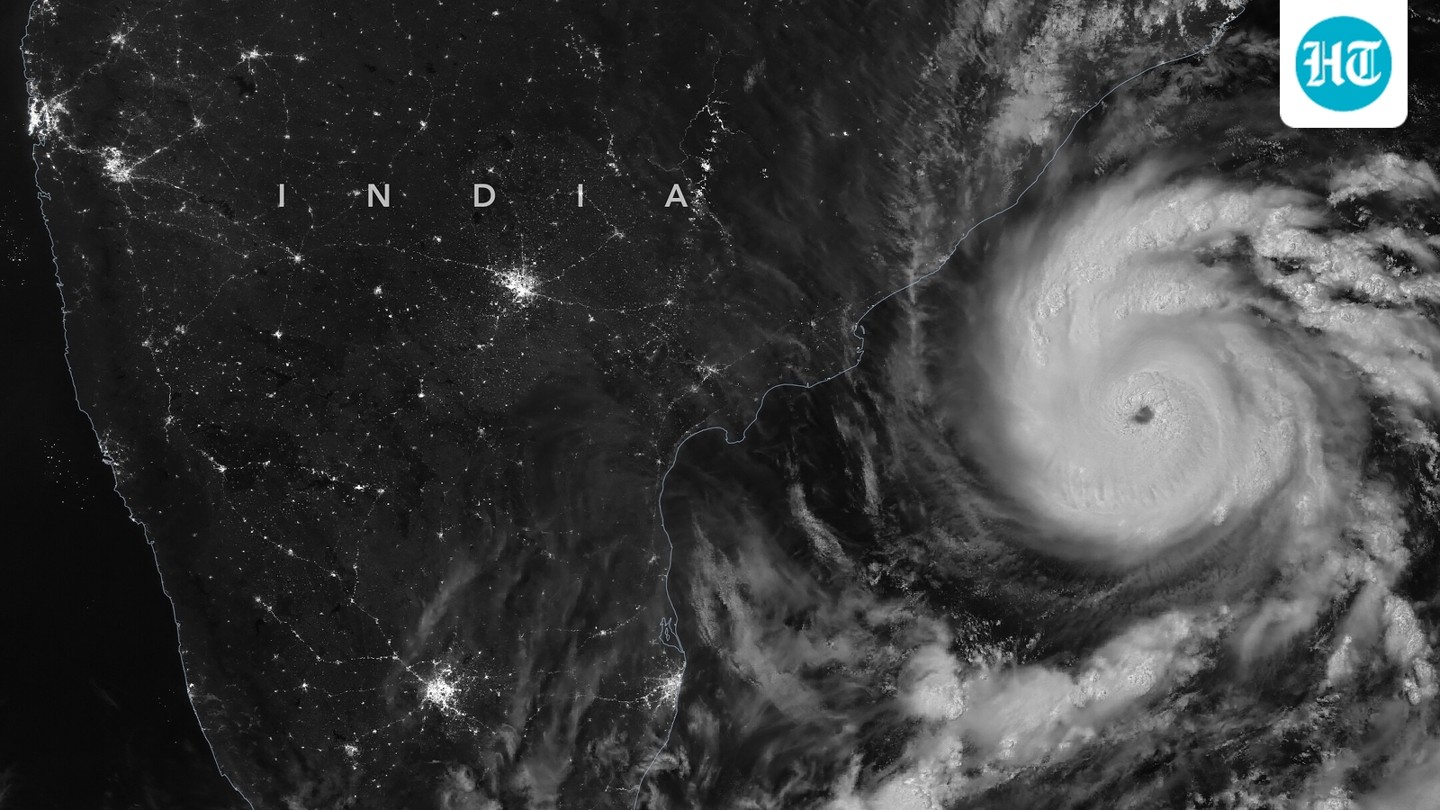
NASA captures nighttime image of Cyclone Arnab two days before it battered Andhra Pradesh
By Roshan Tony4 min read at Hindustan Times
In brief
NASA's satellite captured a nighttime image of Cyclone Arnab in the Bay of Bengal two days before it made landfall on the Andhra Pradesh coast, causing significant damage.
The storm, classified as a very severe cyclonic storm by the IMD, brought strong winds and heavy rain, leading to widespread destruction and the evacuation of over 10,000 people.
The article also notes that Arnab's development during the ongoing El Niño period runs counter to typical patterns for the region.
This is an AI-estimated analysis and may not reflect the article's actual intent or the publisher's editorial position.
Read this page in Telugu · Google Translate (opens translate.google.com in a new tab)Machine translation by Google, not checked by Vekuva
At a glance
- Tone: cautious
- Ownership not yet recorded
- Coverage: only Hindustan Times so farWhat is this?
Cyclone Arnab left parts of the Andhra Pradesh coast battered after bringing strong winds and heavy rain. Amid the storm's passage, NASA's satellite captured a nighttime image of Cyclone Arnab as it moved across the Bay of Bengal. The image was captured two days before the landfall.
According to the India Meteorological Department (IMD), the storm sustained with winds of around 140 kilometres per hour.
That is the opening of Hindustan Times’s story. The full report is on their site.
Read the full story at Hindustan Times (opens in a new tab)