Analysis. Vekuva's measurement of another outlet's report. The reporting is the outlet's; the framing analysis is ours. · Hindustan Times
Vekuva’s reading of Hindustan Times’s report
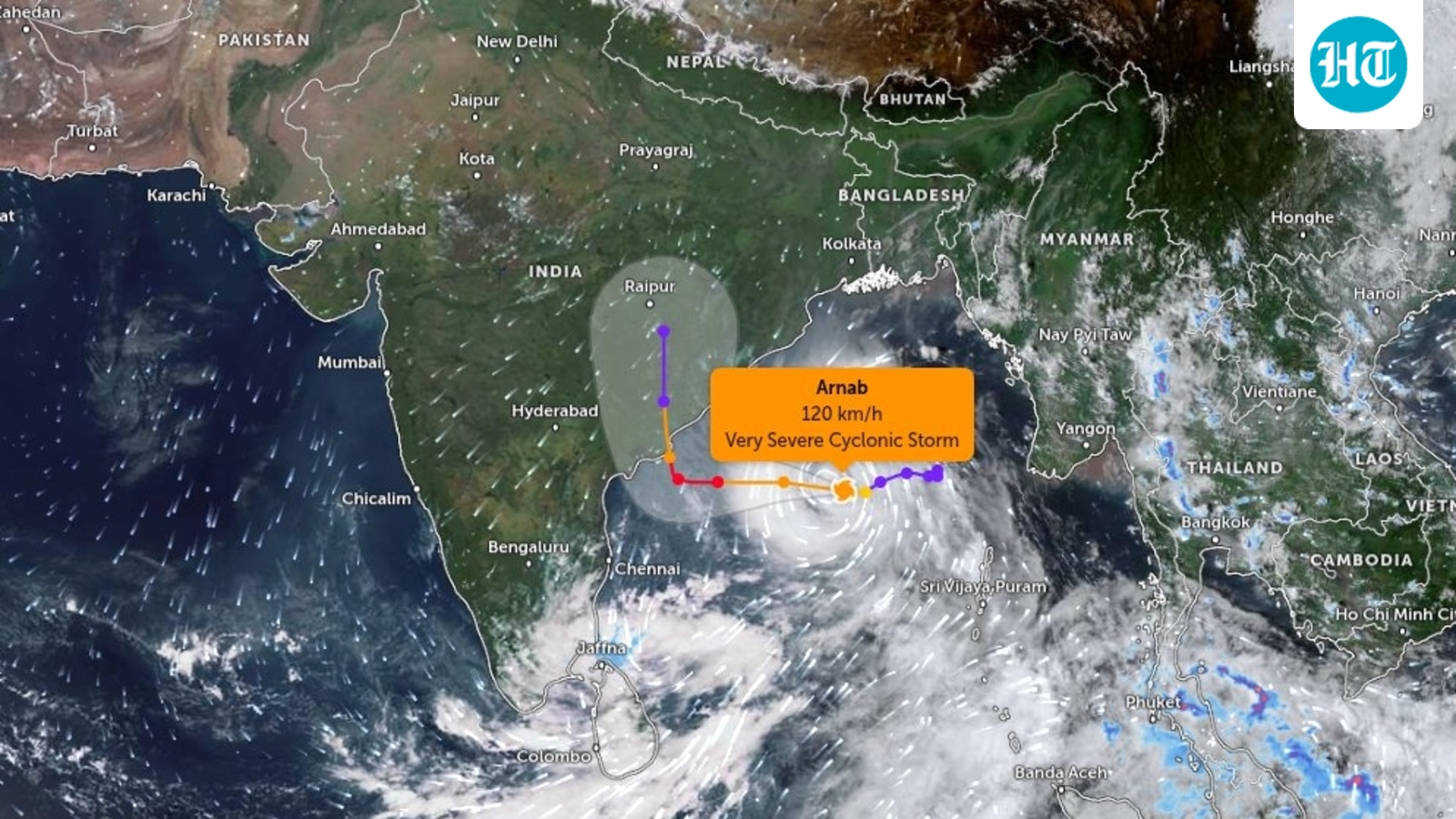
Satellite image shows Cyclone Arnab moving towards Andhra as storm intensifies over Bay of Bengal ahead of October 28 landfall
By HT News Desk4 min read at Hindustan Times
In brief
The India Meteorological Department (IMD) is tracking Cyclone Arnab in the Bay of Bengal, forecasting it will intensify and make landfall near the Andhra Pradesh–Yanam coast between Bapatla and Visakhapatnam by October 28.
This is an AI-estimated analysis and may not reflect the article's actual intent or the publisher's editorial position.
Read this page in Telugu · Google Translate (opens translate.google.com in a new tab)Machine translation by Google, not checked by Vekuva
Satellite imagery from India’s INSAT-3DS weather satellite is tracking Cyclone Arnab over the east-central and adjoining west-central Bay of Bengal, with intense convective cloud activity accompanying the developing storm as it moves towards India’s eastern coastline, particularly Andhra Pradesh and neighbouring Odisha. Track live updates
The India Meteorological Department (IMD), in its satellite bulletin issued at 8:30 am IST on Monday, identified the storm’s centre near 15.5°N latitude and 88.8°E longitude. The satellite analysis reported moderate to very intense convective activity around the system, indicating substantial thunderstorm development associated with the cyclone.
That is the opening of Hindustan Times’s story. The full report is on their site.
Read the full story at Hindustan Times (opens in a new tab)